

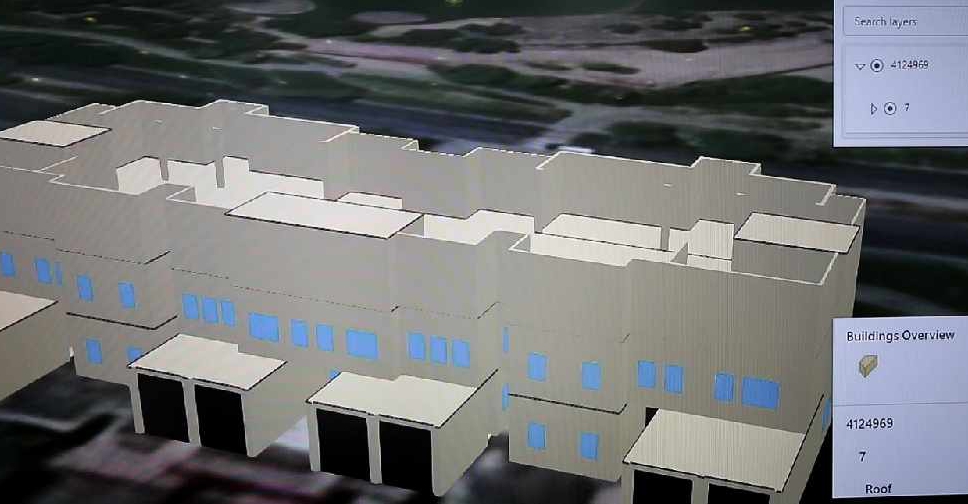
Dubai Municipality has launched an electronic system that provides access to geospatial data and maps of the emirate.
It features digital 2D and 3D replicas of all the landmarks and infrastructure facilities with details ranging from building masterplans and interiors to external green areas, bridges, tunnels and service lines.
The system called ‘Dubai Here’ also provides access to details of housing units and information on economic activity, the environment, health and population.
It’s accessible on a web browser or smart device, and is designed to be easily updated.
The project will help officials with urban planning and managing services related to infrastructure, security and health.
.@DMunicipality launches ‘Dubai Here’, an e-system that provides comprehensive geospatial data and maps of #Dubai https://t.co/91qKK5FAqc pic.twitter.com/ce4aOJHoaB
— Dubai Media Office (@DXBMediaOffice) June 22, 2020
The municipality has also signed an agreement with the Roads and Transport Authority (RTA) for enhanced cooperation in the geospatial infrastructure of Dubai.
.@rta_dubai, @DMunicipality sign geospatial infrastructure service level agreementhttps://t.co/v5YDsQTl7Y pic.twitter.com/fTqOBl4MjY
— Dubai Media Office (@DXBMediaOffice) June 22, 2020


 Dubai rejects claims of Iranian attack on data centre
 Some UK education boards cancel IGCSE, A-level exams for UAE
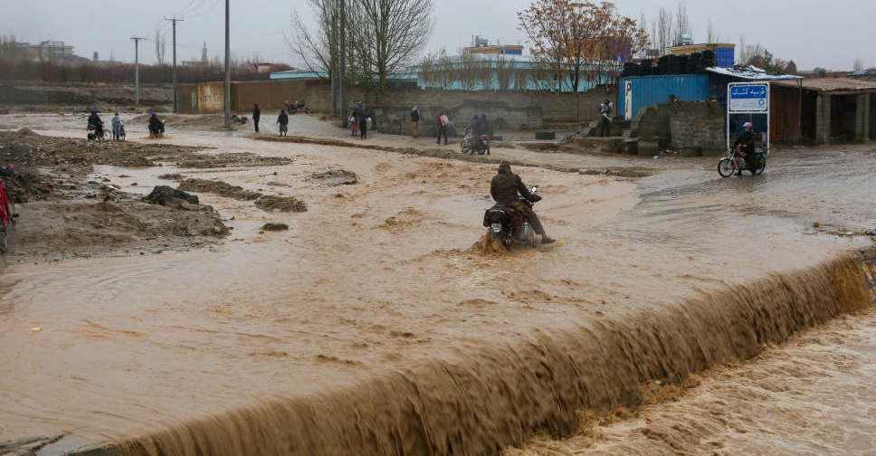 UAE expresses solidarity with Pakistan and Afghanistan over devastating floods
 UAE President and King of Jordan discuss regional developments
 UAE intercepts 19 ballistic missiles and 26 drones on Thursday
 UAE, seven other nations strongly condemn Israel's death penalty law
 Minor damage reported after missile interception in Abu Dhabi
 UAE emphasises maritime navigation security at IMO session